Bernina Trek: The Ultimate Hiking Guide
Planning the Bernina Trek in Switzerland? Route, SAC huts, costs, difficulty, gear and first-hand day-by-day notes from a 7-day hut-to-hut crossing of the Engadin.
Hiked by Lee
Self-guided
Last verified
Planning to hike the Bernina Trek in Switzerland? This guide covers everything I learned hiking the route through the Swiss Alps — including the route, mountain huts, costs, difficulty, gear, food, water, navigation and the things I wish I'd known before starting.
The classic Bernina Trek (Via Bernina) is roughly 135 km over 7 stages, travelling from Madulain to Poschiavo through spectacular high-alpine scenery in Switzerland's Engadin region. I hiked my own version over seven days, covering around 146 km and 6,000 m of climbing after detours and route choices along the way.
Use the Bernina Trek overview for quick stats, the Trek Cost Calculator for a CHF budget model, and the Packing List Builder when you're ready to pack.
Bernina Trek — Quick Facts
| Country | Switzerland (Graubünden) |
| Classic route | ~135 km · ~6,200 m ascent |
| Duration | 7 days · 6 mountain-hut nights |
| Start / finish | Madulain → Poschiavo |
| Accommodation | SAC mountain huts (half-board typical) |
| Difficulty | Challenging |
| Recommended pack | 30–40 L |
| Typical season | Late June – early October (best: July – mid-September) |
My journey: ~146 km · ~6,000 m ascent over 7 days. Distances below sometimes show both the official stage and my GPS day where they differ.
Always check current trail conditions, weather, transport and hut information before leaving. Mountain conditions and services change.
What Is the Bernina Trek?
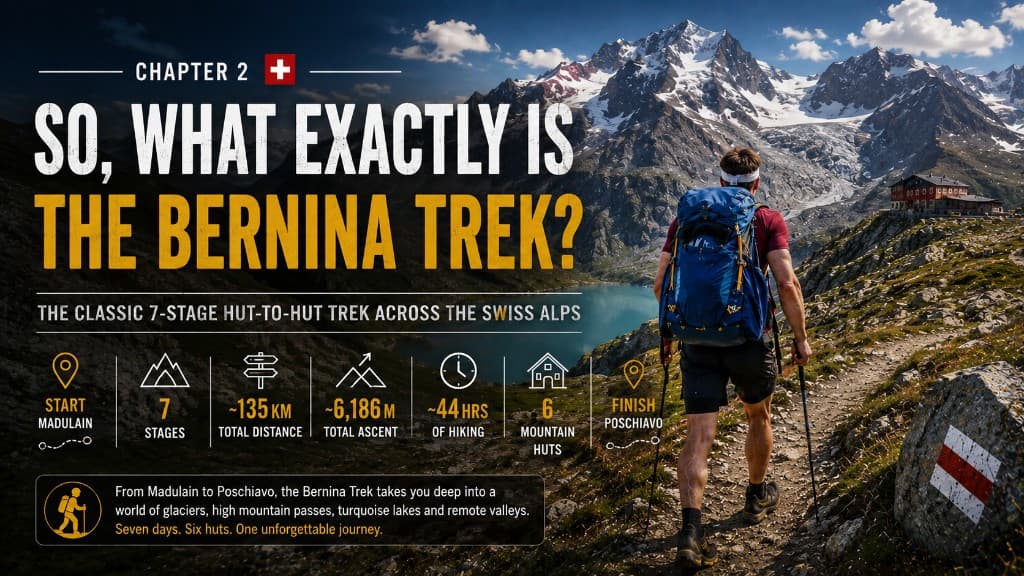
The Bernina Trek is a seven-stage, hut-to-hut hike through the Bernina region of eastern Switzerland — starting in the Engadine village of Madulain and finishing much further south in Poschiavo.
This isn't really a village-to-village walking trail. For most of the journey you're moving from one remote SAC mountain hut to another — crossing high passes, rocky valleys and wild alpine terrain. You're essentially travelling around the Bernina massif, home to Piz Bernina (4,049 m), the highest peak in the Eastern Alps. You're not climbing it — but your legs may occasionally feel like you are.
Compared with something like the Alta Via 1, Bernina felt wilder: fewer hikers, longer stages, rougher trail in places, and at times you're a long way from the nearest town. Some sections are straightforward hiking; others are considerably less straightforward.
You don't need to be a mountaineer. But I wouldn't call this a beginner trek either. You need good fitness, confidence on rocky mountain terrain, and the ability to handle some very long days. My longest took almost eleven hours — which is a very long time to reconsider your packing decisions.
My 7-Day Journey on the Bernina Trek
Here's what each stage actually felt like — the highlights, the hard parts, and what a future hiker should know. Watch the silent Via Bernina hiking film for the full cinematic version of this trip.
Day 1 — Madulain → Chamanna d'Es-cha
My day: 8 km · +900 m
Day One started in Madulain after a short train ride from Pontresina. On paper this looked easy — eight kilometres. There was just one small detail: 900 metres of climbing.
The first half was gentle — forest, wide views across the Engadin Valley and perfect weather. I quickly discovered two things that would follow me all week: flies, and a backpack that was far too heavy (camera gear, batteries, and a physical book because I was still doing 75 Hard).
The final climb became steeper and rockier before Chamanna d'Es-cha appeared above me. Day One ended with a hot shower, coffee on the terrace and a four-course dinner. Swiss mountain hiking wasn't looking too bad.
Day 2 — Es-cha → Chamanna Jenatsch
My day: ~25 km · +1,200 m · ~8.5 hours
Day Two was where the Bernina Trek stopped being polite. Twenty-five kilometres, around 1,200 metres of climbing, and another very warm day.
The scenery kept improving — I found an incredible lake for lunch. Then came the descent: steep, rocky, and brutal on the legs. By now the backpack was cutting into my shoulders.
Eventually I reached the river, refilled water and started the long climb toward Jenatsch. The final kilometre was cruel — you can see the hut, you know you're almost there, it just refuses to get any closer.
After eight and a half hours: Chamanna Jenatsch, sitting right beside a glacier. No shower. At this point Switzerland had decided I'd had enough luxury.
Day 3 — Jenatsch → Chamanna Coaz
My day: ~30 km · +1,300 m · ~11 hours
The hardest day of the entire trek.
It started with a climb toward the pass — proper mountain terrain. Huge rocks, steep gradients, very little obvious trail. Navigation slowed right down. I did get some company from ibex who were handling the rocks considerably better than I was.
Going down was worse: steep enough that there were sections where I was scrambling — and occasionally sliding down on my backside.
Eventually I reached civilisation, stocked up on food and water, and prepared for another enormous climb. Then I discovered the Corvatsch gondola — CHF 31 one-way to Murtèl. Take. My. Money.
From the top I headed back into the mountains. Clouds were building, my legs were finished, and almost eleven hours after starting, Coaz finally appeared. Another hut, another glacier, still no shower.
Day 4 — Coaz → Chamanna da Tschierva
My day: ~14 km · +700 m · ~4.5 hours
Day Four was supposed to be the recovery day — about eight kilometres on paper. Except part of the trail was closed, and a detour pushed it to around fourteen kilometres including some backtracking.
Honestly, this became one of the most enjoyable days. My legs weren't completely destroyed and I could stop and appreciate where I was. I arrived around lunchtime, ordered fresh fruit and yoghurt, and sat looking straight at another enormous glacier. Then a major storm arrived. Getting to the hut early was the best decision of the day.
Day 5 — Tschierva → Boval
My day: 24.3 km · +800 m · ~7.5 hours
More backtracking — but downhill, early, beside a river. Then suddenly: people. Lots of people. I'd walked straight back into Pontresina, the same town where I'd stayed before starting. Which meant second breakfast, coffee, and a pharmacy stop.
After Pontresina the trail headed back into the mountains beside the Morteratsch glacier — beautiful, hot, rocky and increasingly busy with day hikers. Seven and a half hours after leaving Tschierva, I reached Boval. No shower. Wet wipes had officially become part of my personality.
Day 6 — Boval → Rifugio Saoseo
My day: 34.5 km · +1,026 m · ~9.5 hours
The longest day — and probably my least favourite.
The morning was gorgeous: I left around 6 a.m. and had the trail almost completely to myself. Then came a lot of road walking. Eventually I reached Lagalb and headed back into the mountains — lakes, cows, huge views, and rapidly rising temperatures.
Around lunchtime I found a restaurant. Everyone was speaking Italian. The pasta was suspiciously affordable for Switzerland. I'd accidentally walked into Italy before crossing officially back into Switzerland.
The final part was more road, tricky navigation through farmland, and a very long climb to Saoseo. Nine and a half hours after leaving Boval, I was done. But there was a warm shower. Best hut in Switzerland.
Day 7 — Saoseo → Poschiavo
My day: 14.3 km · +320 m · ~4.5 hours
The final morning. Saoseo gave me one of the best sunrises of the trip. The hut had promised an early breakfast. The hut had lied — breakfast was energy bars.
My legs and back were tired. The day started with another decent climb through forest, then dropped toward Poschiavo. After seven days, 146 kilometres and around 6,000 metres of climbing, I was finished.
Seven days earlier I'd arrived wondering whether Switzerland really deserved all the hype. Now I understood.
The Official 7-Day Route (How to Plan It)
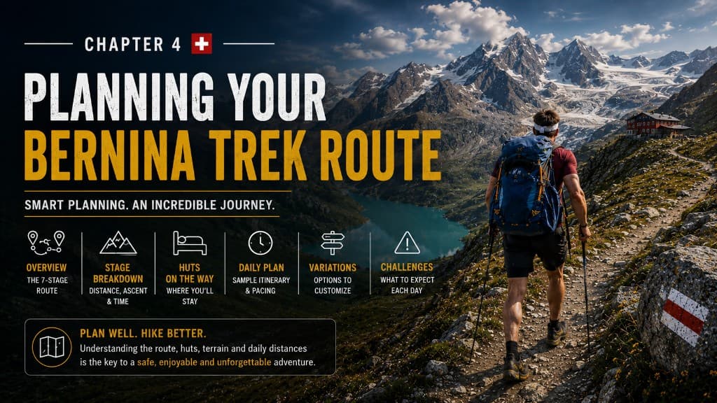
My route isn't necessarily the one I'd recommend blindly copying. There were detours, very long stages, transport sections and road walking — and a few things I'd definitely change. Here's the classic Bernina Trek as published by Engadin Tourism.
| Day | Stage | Distance | Ascent | Time (approx.) |
|---|---|---|---|---|
| 1 | Madulain → Chamanna d'Es-cha | 5.9 km | +897 m | ~2h 40 |
| 2 | Es-cha → Jenatsch | 23.9 km | +1,090 m | ~8 h |
| 3 | Jenatsch → Coaz | 28.2 km | +1,749 m | ~8h 45 |
| 4 | Coaz → Tschierva | 13.4 km | +663 m | ~4h 50 |
| 5 | Tschierva → Boval | 22 km | +705 m | ~6h 40 |
| 6 | Boval → Rifugio Saoseo | 28.4 km | +772 m | ~9 h |
| 7 | Saoseo → Poschiavo | 14.2 km | +316 m | ~4h 30 |
Classic totals: ~135 km · ~6,186 m ascent · ~44 hours on trail.
Important planning notes
- Short ≠ flat. Day One is only six kilometres — with almost 900 metres of climbing.
- Day Three is the big one. Rough terrain, tricky navigation in places, and a lot of vertical. Take it seriously.
- Corvatsch cable car is part of the classic route (Surlej → Corvatsch → Murtèl on Stage 3). Taking the lift isn't cheating — it's how the itinerary is designed to work.
- Check trail closures every day. When I hiked, a closure on Stage 4 turned a short day into fourteen kilometres. Engadin Tourism also routes Stage 5 via Pontresina when Val Roseg sections close.
- Stage 6 includes RhB train options between Pontresina and Lagalb on the classic itinerary. I walked considerably more than necessary by not using transport strategically.
- Seven days is realistic for fit, experienced hikers — but there's no prize for reaching the hut completely destroyed. Splitting a monster stage or adding an eighth night is completely valid.
Before you leave, check: hut openings · trail closures · lift/train schedules · weather. Download your route offline.
Mountain Huts: Sleeping, Eating & Surviving
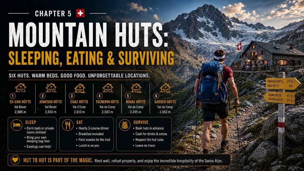
One of the best things about the Bernina Trek is that you don't need camping gear. Every night you finish at a mountain hut — and some locations are frankly ridiculous (glaciers outside the window, mountains in every direction, and occasionally even a shower).
Most huts belong to the Swiss Alpine Club (SAC). Think somewhere between a mountain hostel and a very well-organised sleepover with dozens of strangers. Simple, but they give you bed, dinner and breakfast.
Half-board
I booked half-board most nights: bed, dinner and breakfast included. My first night at Es-cha was a four-course dinner. Breakfast everywhere else was functional — bread, cheese, muesli, jam, coffee. Enough fuel to climb a mountain; not necessarily enough excitement to photograph.
For longer stages, order a packed lunch the night before. A mediocre sandwich becomes a very good sandwich when you've climbed a mountain to eat it beside a lake.
If you've got a long stage ahead, tell the hut the night before you want to leave early. At Jenatsch I arranged a 5 a.m. breakfast for Day Three. At Saoseo on Day Seven… the promised early breakfast wasn't there. Emergency food exists for a reason.
The great shower lottery
| Hut | Shower (my trip) |
|---|---|
| Es-cha | Yes |
| Jenatsch | No |
| Coaz | No |
| Tschierva | — |
| Boval | No |
| Saoseo | Yes (warm — five stars) |
By Boval I was on Day Three without a shower. Wet wipes stopped being emergency equipment and became my primary hygiene strategy.
Practical hut tips
- Book every hut before you start. Each hut has its own booking system — there isn't one chain running the Bernina Trek. Book the full chain together once your dates are set.
- Carry Swiss francs even though many huts take cards. Remote mountains are not where I'd test whether Apple Pay is feeling cooperative.
- Sleeping is dormitory-style for most hikers. Bring a sleeping-bag liner and earplugs.
- Don't treat huts purely as somewhere to sleep. Get there early when you can, take the pack off, order coffee, sit outside. Some of my favourite moments happened after the hiking stopped.
Budget (half-board, non-SAC member): roughly CHF 85–100 per person per night → about CHF 510–600 for six nights (includes twelve meals). SAC membership typically saves CHF 10–15 per night.
When Should You Hike the Bernina Trek?
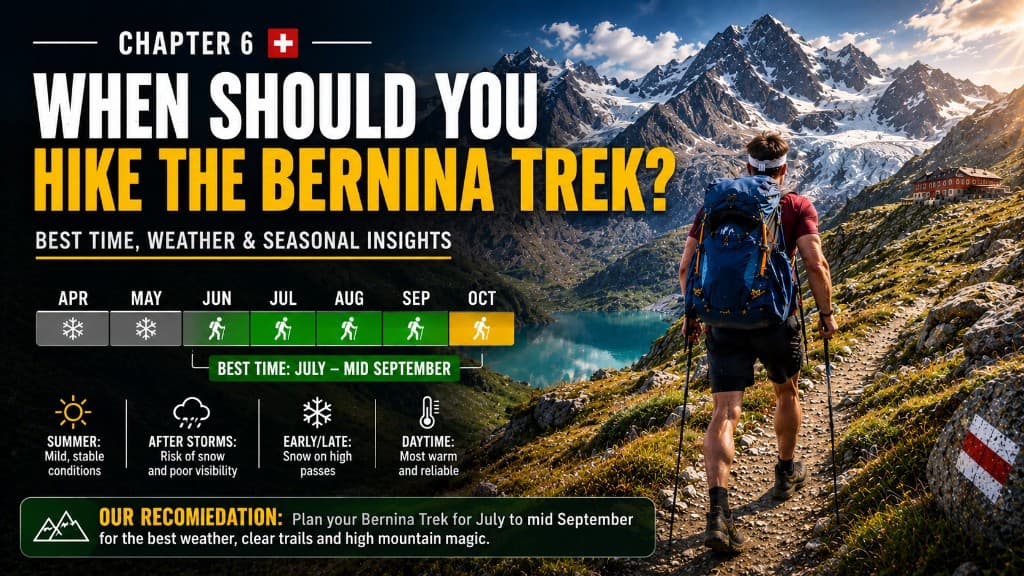
The official hiking window is roughly late June to early October, when huts are staffed and the route is generally accessible.
| Period | What to expect |
|---|---|
| Late June | Long days, fewer hikers, but snow can still sit on high passes — check actual trail conditions, not just hut opening dates. |
| July | Probably the safest all-round choice. Huts operating, snow usually cleared, long daylight for big stages. |
| August | Peak season — best trail conditions, but it can get really hot on exposed sections. I had several brutally warm days. |
| September | My pick for cooler temperatures and quieter trails. Major huts still generally staffed. |
| October | Possible early in the month, but pushing toward the edge of the season — partial staffing, shorter days, early snow risk. |
My recommendation: aim for July through mid-September, and check the forecast every single morning. Start early on long days — cooler, quieter, and more margin if weather turns later.
Conditions on high passes can differ completely from what it looks like on the hut terrace. Ask hut staff before you cross a pass. If they tell you not to — this is not the moment to demonstrate personal growth.
Getting There & Back
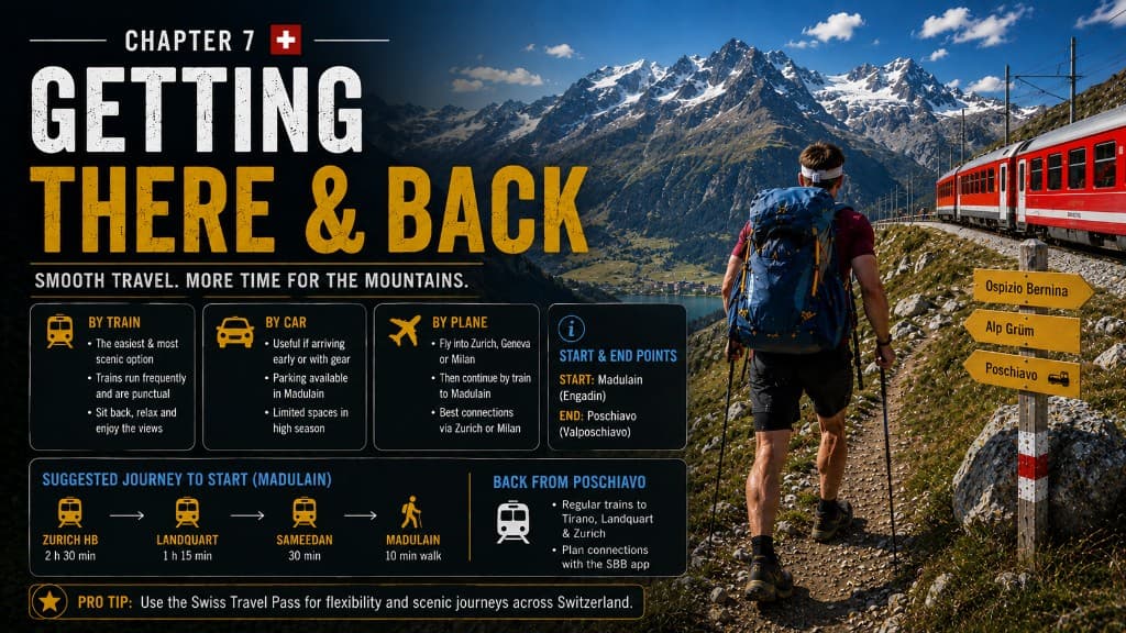
The Bernina Trek is public-transport friendly. You really don't need a car for a point-to-point route from Madulain to Poschiavo.
Before the trek
For most international hikers, Zurich is the easiest gateway. From there, take the train into Graubünden and onto the Rhaetian Railway (RhB) network to Madulain (or nearby Zuoz).
I'd recommend staying one night in Pontresina before Day One — time to buy anything forgotten, check weather, repack, and ease into the Engadin. On trek morning: breakfast, train to Madulain (~30 minutes for me), then straight onto the trail.
After the trek
You finish by walking into Poschiavo — with a railway station right there.
Option A: Train north toward St Moritz / Chur / Zurich.
Option B (what I did): Continue south to Tirano, Italy — then take the Bernina Express (or a regular RhB regional train on the same line) back through the landscapes you've just spent a week hiking through. Sitting in a panoramic carriage after seven days of walking feels surprisingly luxurious.
My return: Poschiavo → Tirano (overnight) → Bernina Express to Chur → Zurich → overnight train to Amsterdam.
Check current timetables before you travel. Bernina Express panoramic seats require a reservation surcharge in peak season; regional trains use the same railway without the ceremony.
What to Pack
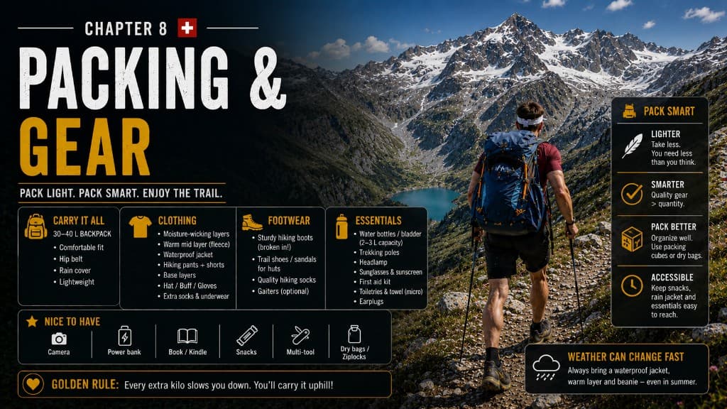
My biggest mistake: the backpack was far too heavy. Camera equipment, batteries, too many clothes, and a physical book. On 25–30 km mountain days, every unnecessary kilogram eventually introduces itself.
Pack size and weight
This is hut-to-hut — no tent, no sleeping bag, no week of food. Aim for a 30–40 litre pack, loaded as light as practically possible while keeping proper mountain safety kit.
Core kit
Wear / pack:
- Hiking shirt and trousers/shorts you trust
- 1 spare shirt, 1–2 underwear, 1–2 spare socks
- Lightweight fleece + insulating layer + waterproof shell
- Lightweight hut clothes
- Cap, sunglasses, sun protection
Gear:
- Trekking poles — especially on long descents
- Boots/shoes with good grip on rocky terrain (broken in before Switzerland)
- Phone with offline maps/GPX + power bank
- Headlamp, small first-aid kit, emergency blanket
- Sleeping-bag liner, earplugs, small quick-dry towel, minimal toiletries
- CHF cash + ID + bank card
- Water capacity at least 1.5 L (I'd want 2 L+ capacity on hot long stages)
- Electrolytes on hot days; emergency snacks always untouched until needed
Optional: camera/drone — be ruthless. If you don't know why you need it, it stays home.
Build a checklist in the Packing List Builder.
How Much Does the Bernina Trek Cost?
Switzerland is expensive. But once you're on trail, accommodation, breakfast and dinner are largely bundled through half-board.
On-trail budget (7 days)
| Item | Budget | Comfortable |
|---|---|---|
| Huts + half-board (6 nights) | CHF 500 | CHF 600 |
| Lunch / snacks / coffee | CHF 100 | CHF 200 |
| Trail transport (gondola, RhB, buses) | CHF 50 | CHF 100 |
| 7-day trek subtotal | ~CHF 675 | ~CHF 900 |
Corvatsch gondola (Stage 3): ~CHF 31 one-way (Surlej → Murtèl).
Bernina Express Tirano → Chur (optional): ticket ~CHF 66 + panoramic reservation ~CHF 44 in peak season (~CHF 110 total second class). Regional trains on the same line cost less.
Add pre/post hotels (CHF 120–250+ per night in the Engadin), international travel, and gear separately.
Model your numbers in the Trek Cost Calculator.
Where not to save: food on trail, safety gear, or footwear.
Where to save intelligently: SAC membership if you'll do more Swiss hut trips, packed lunches instead of restaurant meals every day, regional trains instead of panoramic carriages, and a lighter pack so you don't buy gear you don't need.
How Hard Is the Bernina Trek?
Officially rated difficult: ~135 km, 6,000+ m ascent, ~44 hours on trail over seven days.
This is hiking, not mountaineering — no ropes, crampons or ice axe in normal summer conditions. But it's proper Swiss mountain hiking: steep ground, loose rock, uneven surfaces, and sections where sure-footedness matters.
For me the biggest challenge was endurance, not technical difficulty. You're not doing one hard hike — you're waking up and doing another one tomorrow.
Day Three was where terrain became a bigger factor: rocky pass, slow navigation, brutal descent.
My difficulty rating:
| Rating | |
|---|---|
| Fitness | 4 / 5 |
| Technical | 3 / 5 |
| Navigation | 3 / 5 |
| Exposure | 2 / 5 |
| Overall | Challenging (4 / 5) |
Could a beginner do it? Maybe — but not as their first mountain trek. Before Bernina you should be comfortable with 20–25 km mountain days, 1,000 m+ climbing, 6–8 hours on your feet, steep rocky descents, and a loaded pack — then doing it again the next day.
Train with: long hikes, vertical, back-to-back days, and your actual pack weight.
Food & Water
You don't need seven days of food. Breakfast and dinner are at huts; you only need to solve everything between them.
- Order packed lunch at the hut the night before on long stages
- Always carry emergency food (energy bars, something sugary) — plans occasionally decide not to participate
- Resupply in Pontresina (Stage 5) and near Silvaplana (Stage 3)
- Start each morning with full bottles; ask hut staff about water on that day's stage
- Clear mountain streams ≠ guaranteed safe — treat if you must rely on them; prefer known hut/village water
- Don't assume unlimited free tap water at every hut — water is a limited resource up here
On hot days I underestimated water needs. Carry capacity for 2 L+ when stages are long and exposed.
Navigation & Safety
Most of the Bernina Trek is well signed and easy to follow — Switzerland has excellent trail marking. Understand the system:
- Yellow — hiking trail
- White–red–white — mountain hiking trail (you'll spend plenty of time on these)
- White–blue–white — alpine hiking trail
Before you start: download GPX and offline maps, save hut locations, charge phone, carry power bank.
Don't follow GPX blindly — an old file doesn't know today's closure. Prioritise current signs and official diversions.
Day Three was the one day I genuinely had to concentrate: when unsure, stop, check the map, find the last marker, backtrack if necessary.
Emergency: save Rega 1414 (Swiss air rescue) and 112. Consider the Rega app. Tell someone your daily hut target when hiking solo.
If serious weather is forecast, don't complete your spreadsheet at the expense of safety. Call the hut, wait, change route, use transport. The goal is to get home.
What I Wish I'd Known
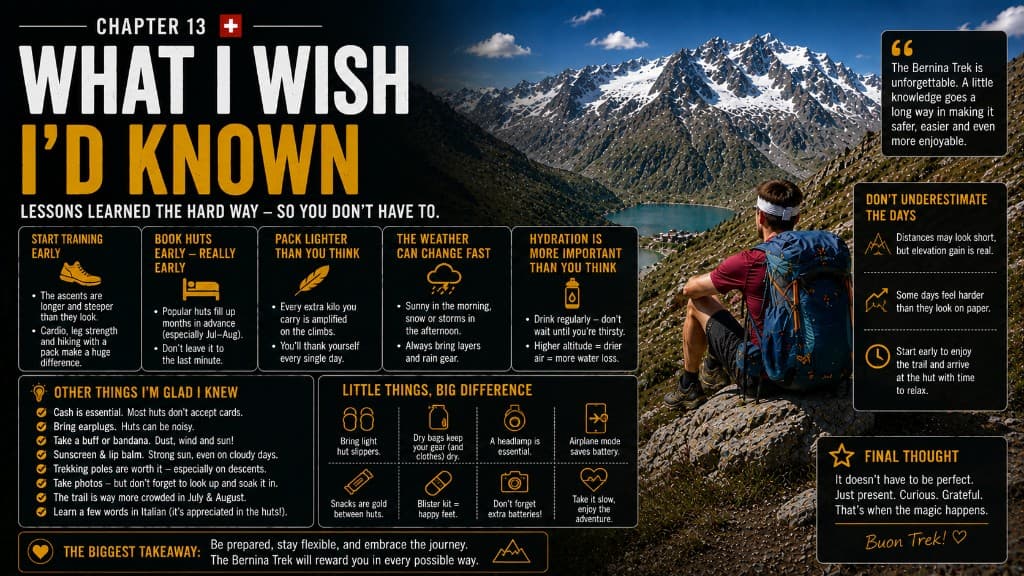
- Pack much lighter — every gram × 146 km
- Start early from Day One — cooler, quieter, more weather margin
- Respect descents — Day Two and Day Three destroyed my legs going down; bring poles
- Transport is part of the route — gondola and RhB are designed in; don't walk 34.5 km for character development
- Check tomorrow's route every evening — closures, weather, transport
- Carry more water capacity than you think — Swiss summer sun is real
- Always have backup food — Saoseo's missing breakfast taught me that
- Showers are a bonus — pack wet wipes and a small towel
- Arrive at huts early sometimes — coffee on the terrace beats rushing
- Be flexible — trails close, weather changes, breakfast doesn't always appear
If I started again tomorrow: smaller pack, 6 a.m. departures, strategic transport, emergency food, flexible water capacity, and considerably fewer "just in case" items.
Should You Hike the Bernina Trek?
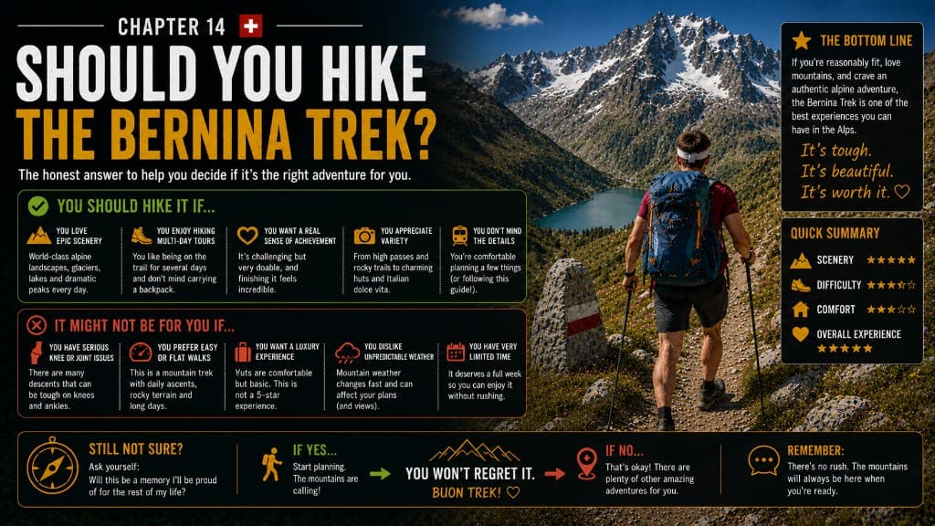
Yes — but not everyone.
Hike Bernina if you:
- Love big mountain scenery and glaciers
- Want a remote-feeling hut-to-hut trek without camping gear
- Enjoy long, challenging mountain days
- Want fewer crowds than famous Alpine circuits
Maybe choose something else if:
- You've never hiked in mountains before
- 25–30 km mountain days sound horrific
- You need private rooms and daily showers every night
- Road walking ruins your emotional wellbeing
How Bernina compares
| Tour du Mont Blanc | Alta Via 1 | Bernina Trek | |
|---|---|---|---|
| Best for | First big Alpine trek | Classic hut-to-hut Dolomites | Quieter, glacier-heavy adventure |
| Feel | Social, flexible lodging | Dramatic rock, more rifugios | Remote, longer stages, fewer hikers |
| Scenery | Mont Blanc massif, 3 countries | Dolomite towers | Huge valleys, glaciers, Bernina massif |
I wouldn't rank them — they're completely different. But Bernina is the one I'd choose when I want something slightly less obvious after TMB or Alta Via 1.
Would I hike it again? Yes — with a considerably smaller backpack.
Final Thoughts
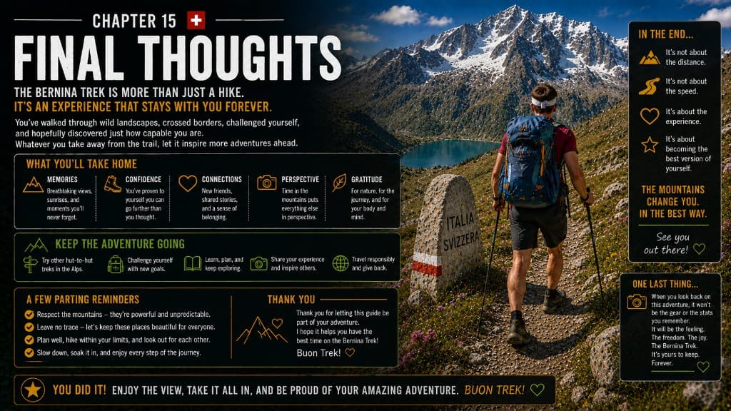
Seven days, 146 kilometres and around 6,000 metres of climbing later, I understood why everyone talks about hiking in Switzerland. It wasn't one glacier or one viewpoint — it was waking up in mountain huts, having valleys almost to yourself, and taking the pack off at the end of a long day knowing you didn't have to put it back on until tomorrow.
The huts are a huge part of what makes this trail special. You stay in the mountains rather than hiking out of them every evening. Bernina felt quieter and wilder than trails like Alta Via 1 or the TMB — bigger days, fewer people, and landscapes on a scale that photographs struggle to capture.
Not every kilometre was perfect. Day Three was brutal. Day Six had too much road. My pack was ridiculous. But that's also what made it feel like a proper adventure rather than a postcard tour.
If you've already done a hut-to-hut trek and want something slightly less obvious — glaciers, long stages, and the Engadin to Poschiavo crossing — put Bernina on your list.
Quick Planning Checklist
- Best time: July – mid-September
- Days: 7 (6 hut nights)
- Distance: ~135 km classic · ~6,200 m ascent
- Difficulty: Challenging
- Pack: 30–40 L, as light as possible
- Start: Madulain (train from Pontresina)
- Finish: Poschiavo
- Book: All huts in advance, individually
- Budget: ~CHF 675–900 on-trail (excl. flights/hotels)
- Biggest tips: Pack light · start early · use transport where designed · check route nightly
Photo credits
Supplementary images in this guide are from Wikimedia Commons under Creative Commons licences: Morteratsch Glacier, Piz Bernina, Poschiavo valley. See file pages linked in site image metadata.
Last verified: August 2026. Distances and prices are planning references from my hike and published Engadin/SAC sources — always confirm current hut rates, trail status and transport before booking.
Next guide
Bernina Trek Itinerary: 7-Day Stage Guide
Official 7-day Bernina Trek itinerary — km, ascent, hiking time and SAC hut stops from Madulain to Poschiavo, plus Lee's GPS days.