The Laugavegur Trek Iceland | Self-Guided Complete Guide
Iceland’s Laugavegur trek is one of the world’s most breathtaking multi-day hikes, yet planning it on your own can feel overwhelming. The Laugavegur is also famously known as Iceland’s ‘hot springs route,’ celebrated for its geothermal landscapes, thermal pools, and status as a scenic multi-day hiking experience. From huts and permits to unpredictable weather, many hikers struggle to find reliable details before stepping onto the Laugavegur trail. Without clear guidance, you risk missing highlights or arriving unprepared for the challenges.
That’s why this Laugavegur guide was created—to give you everything you need in one place. Whether it’s your first long-distance trek or your next big adventure, this guide will help you plan with confidence and hike the trail like a pro.
Also Read: The Alta Via 1 Full Guide
What is the Laugavegur Trek Iceland?
The Laugavegur hiking trail is Iceland’s most famous long-distance hiking route, stretching about 55 kilometers (34 miles) through the country’s wild highlands. It typically takes 3–4 days to complete, connecting the geothermal wonderland of Landmannalaugar with the lush valley of Þórsmörk.
Also Read: Landmannalaugar Hiking Guide
What makes the Laugavegur trail so unique is the diverse landscapes you’ll pass through:
- Colorful rhyolite mountains and undulating hills painted in reds, yellows, and greens
- Steaming hot springs and bubbling mud pools
- Vast black sand deserts and obsidian lava fields
- Sparkling glaciers and snow patches, even in summer
- Lush valleys filled with rivers, waterfalls, and mossy canyons
This trek isn’t just about scenery—it’s about contrasts. One day you’ll be walking across a desert-like plateau, the next you’ll descend into a green valley alive with birdsong. That constant change keeps the journey exciting and unforgettable.
The Laugavegur is well-marked, has mountain huts along the way, and can be hiked self-guided, making it accessible to most hikers with moderate experience. It’s often extended by adding the Fimmvörðuháls trail, which continues from Þórsmörk to Skógar past active volcanoes and towering waterfalls.
Also Read: Hiking Iseltwald, Switzerland
Getting to the Laugavegur Trail
Reaching the start of the Laugavegur trail is an adventure in itself. Since the route begins in the remote highlands, you can’t just drive straight there with a regular rental car. Roads into Landmannalaugar are rough, unpaved F-roads, often requiring 4×4 vehicles and river crossings.

Here are the main options:
A public bus service is available during the summer months, providing access to the trailheads.
1. Bus from Reykjavík
- Highland buses run daily in summer (June–September).
- Departures are from the BSÍ bus terminal in Reykjavík.
- Journey takes 4–5 hours.
- Cost: around €60–80 one way.
- Drop-off points: Landmannalaugar (trail start) or Þórsmörk (trail end).
2. Driving Yourself
- A 4×4 vehicle is mandatory to reach Landmannalaugar.
- Expect river crossings, gravel, and bumpy terrain.
- Driving time: 3–4 hours from Reykjavík.
- Parking is available near the trailhead, but spaces can fill up during peak season.
- Pro tip: If you don’t want to risk river crossings, you can park before the rivers and take a highland bus transfer for the last stretch.
3. Organized Transfers & Tours
- Some operators offer shuttle services to and from both trailheads.
- Options include one-way transfers (great for self-guided hikers) or guided treks with transport included.
4. Where to Finish
- The trek officially ends in Þórsmörk, but many hikers continue on the Fimmvörðuháls trail to Skógar.
- From Þórsmörk, buses run back to Reykjavík or to other destinations along the south coast.
- From Skógar, buses and tours connect easily back to Reykjavík.
Book buses or transfers in advance—especially in July and August—as spots sell out quickly. If you’re planning a round trip, many companies sell “hiker’s passes” that cover both the start and finish.
Best Time to Visit the Laugavegur Trail
The Laugavegur trek is only accessible during Iceland’s short summer months, when conditions are safest and transportation services are available. Outside of this window, huts are closed, buses stop running, and heavy snow makes the trail dangerous or impossible.

Hiking Season: Late June – Early September
- Late June – Early July:
Snow still covers parts of the trail. Fewer crowds, but river crossings are icy and challenging. - Mid-July – Mid-August:
Peak season. Best weather, longest daylight hours, and all huts and buses operating. Expect more hikers and fully booked huts. - Late August – Early September:
Cooler temperatures, shorter days, and a higher chance of storms. Trails are quieter, with beautiful autumn colors in the valleys.
Weather on the Trail
Even in summer, conditions change fast:
- Sun, rain, fog, and snow can all happen in a single day.
- Average temperatures: 5–15°C (41–59°F).
- Strong winds are common on exposed ridges and plateaus.
Daylight Hours
- June: Up to 20–22 hours of daylight.
- August: Around 16 hours of daylight.
- September: 12–14 hours of daylight.
Always check the Icelandic Meteorological Office (vedur.is) before starting each stage. Wardens post daily updates at the huts—never skip these.
Hiking the Laugavegur Trail: My 4-Day Journey
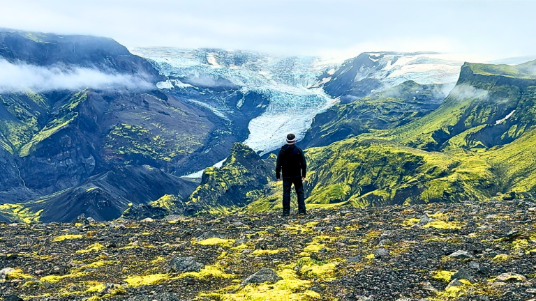
When I first set foot in Landmannalaugar, at the heart of the Fjallabak Nature Reserve in the southern highlands of the Icelandic Highlands, I wasn’t sure what I’d gotten myself into. People had told me the Laugavegur trek was one of the most beautiful hikes in the world, but they’d left out some important details—like how quickly optimism fades when the wind cuts through three layers, or how glacial rivers make you question every life choice before you step in.
The journey began at the famous Landmannalaugar hot springs, a geothermal oasis surrounded by colorful rhyolite mountains and steaming geothermal hot springs. The area is renowned for its natural hot springs and the origin of the trail’s name, which combines the Icelandic words for hot spring and “way.”
Day 1: Landmannalaugar → Hrafntinnusker (12 km | 4–5 hrs)
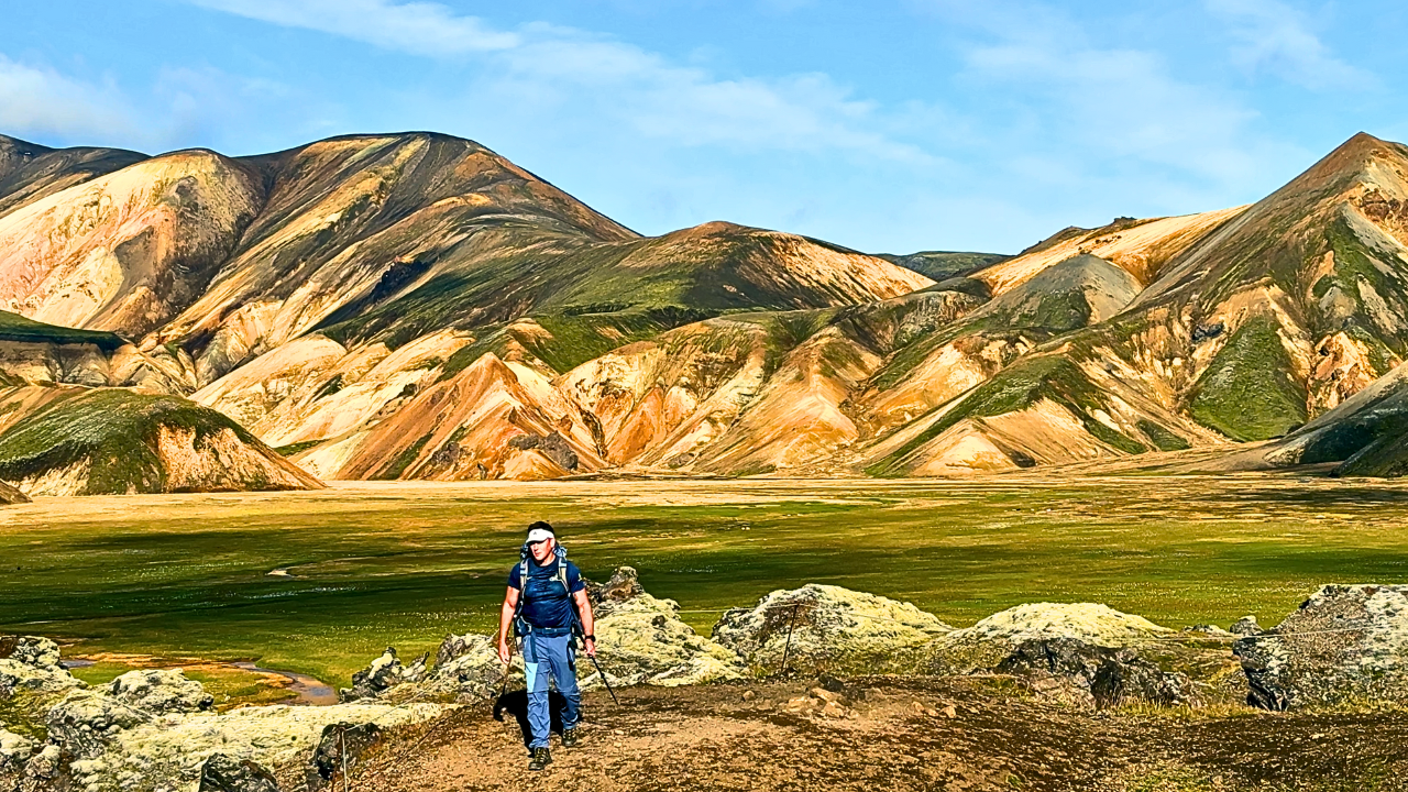
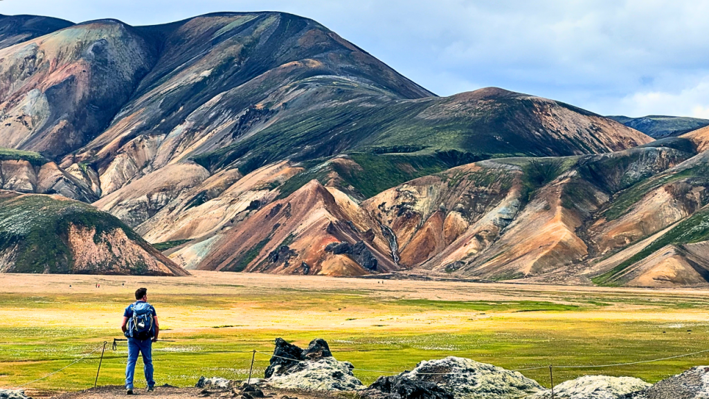
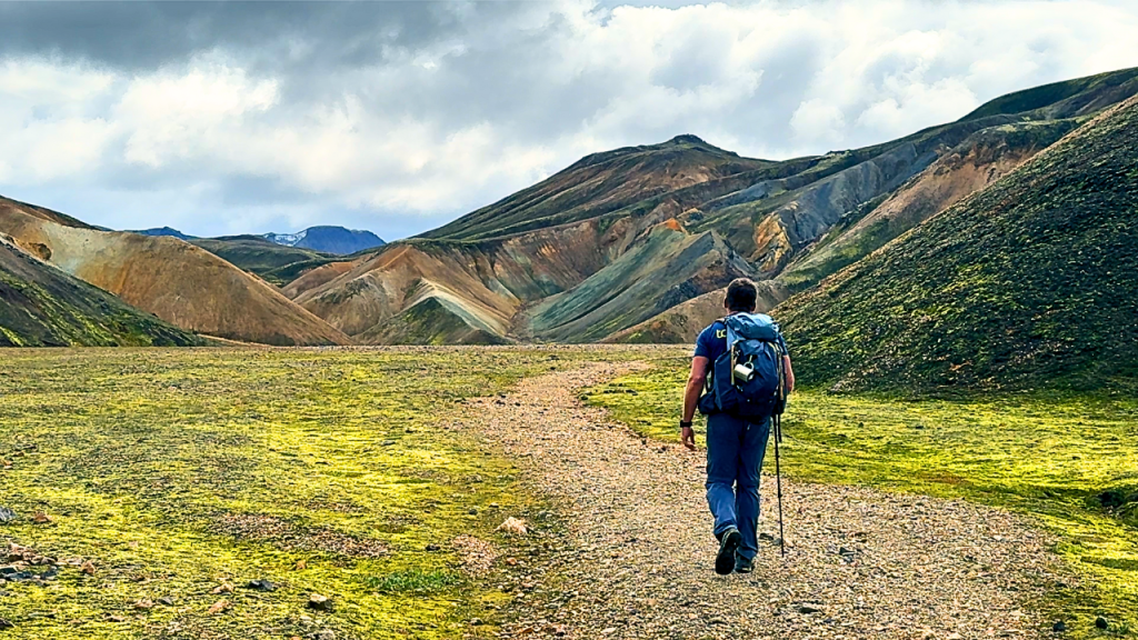
The morning felt almost too kind—blue skies, dry boots, and a trail that welcomed me with rainbow-colored rhyolite mountains and undulating hills. Starting in the heart of the Fjallabak Nature Reserve, the route traverses the Southern Highlands, offering a stunning introduction to Iceland’s wild interior. I stopped constantly to take photos, knowing full well that no picture could capture the scale of it all.
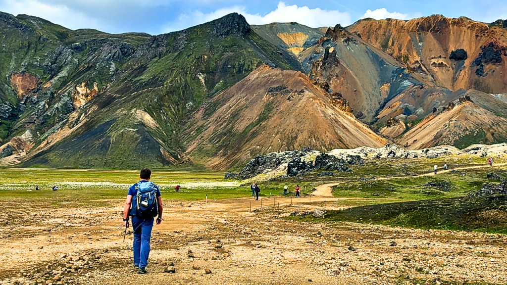
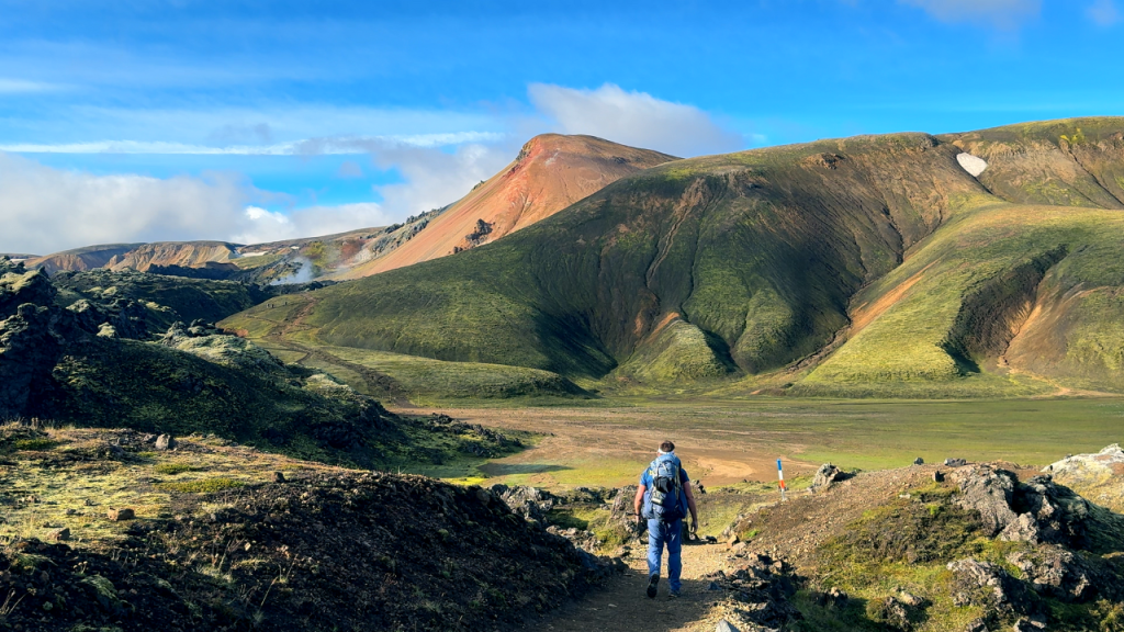
But Iceland doesn’t stay friendly for long. As the landscape shifted, the colorful hills gave way to stark black volcanic slopes and dark mountains. Near Hrafntinnusker, the dark mountains streaked with snow and ice created a dramatic, almost otherworldly scene. By the time I started the steep climbs and steep ascents toward the caldera ridge, the wind was howling. Every step forward on the loose volcanic sand and volcanic terrain came with a slide back, like the mountain was daring me to give up.
The bare obsidian mountainside, made of volcanic rock, loomed ahead, a reminder of the volcanic mountains that define this region. I pulled on gloves, zipped my jacket, and kept going, pausing only to reward myself with a handful of crisp balls—my new favorite trail snack. Along the way, I carefully crossed snow bridges, grateful for their stability in the challenging conditions and steep hills.
Seeing the Hrafntinnusker hut appear out of the mist felt like a miracle. There was a safe hut nearby, offering shelter from the elements. Inside, the warmth of the stove and the kindness of the warden made the whole struggle worth it. I snagged a bunk in the corner, brewed instant coffee (regretting not packing real beans), and watched the storm roll in. That night, as rain hammered the walls, I was grateful to be inside and not in a battered tent.
Day 2: Hrafntinnusker → Álftavatn (12 km | 4–5 hrs)
I woke up nervous. The forecast was grim: rain, low visibility, freezing winds. The warden told me, “If you’re going, go now—this is the best it’ll get.” Not exactly comforting.

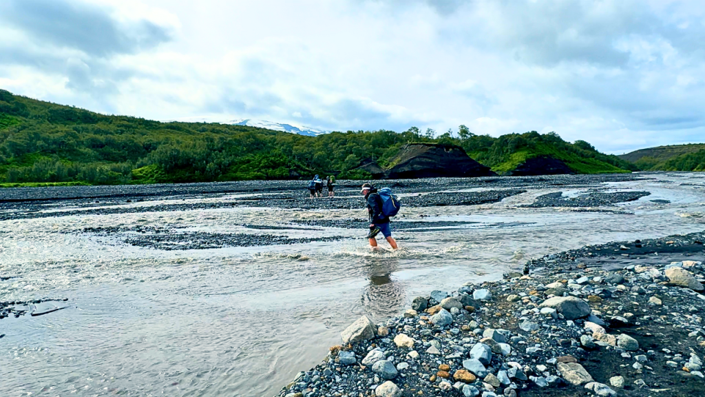
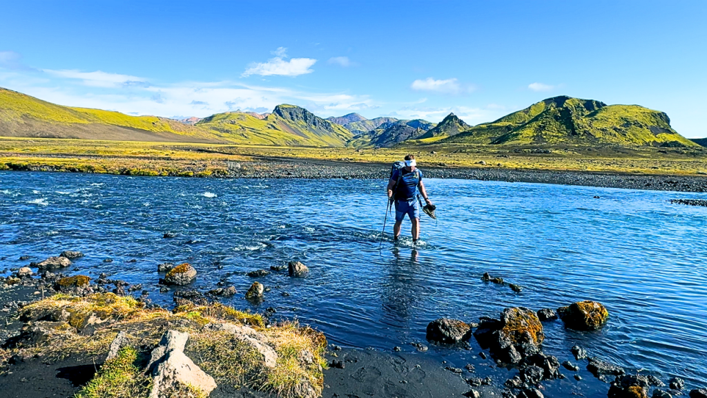
The first stretch was eerie—mist clinging to snow patches, steam rising from the earth, silence broken only by my boots crunching on volcanic grit. It felt like walking through a dream. Then came my first glacier river crossing. I rolled up my pants, slipped on sandals, and waded in. The shock was instant—ice water that made my bones ache. Of course, I crossed three times to get a decent video clip. My feet weren’t amused.
After the high plateau, I began to head downhill, passing through moss covered hills and following a winding river bed. The descent revealed ever-changing scenery, with the landscape opening up as I approached the next highlight.

Along the way, I crossed both the Kaldaklofskvísl river and the Bratthálskvísl river—two notable river crossings that mark this section of the trail.
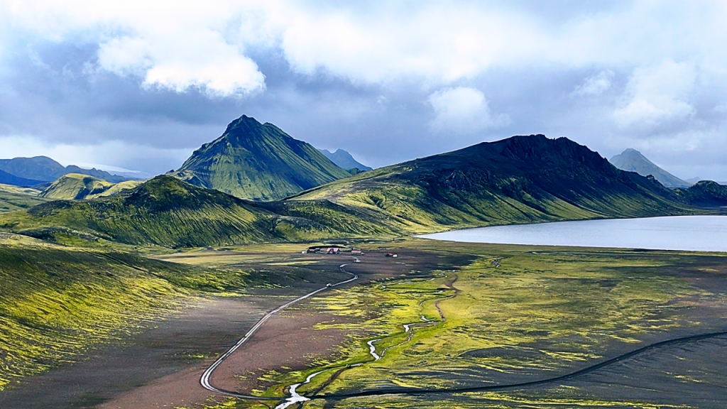
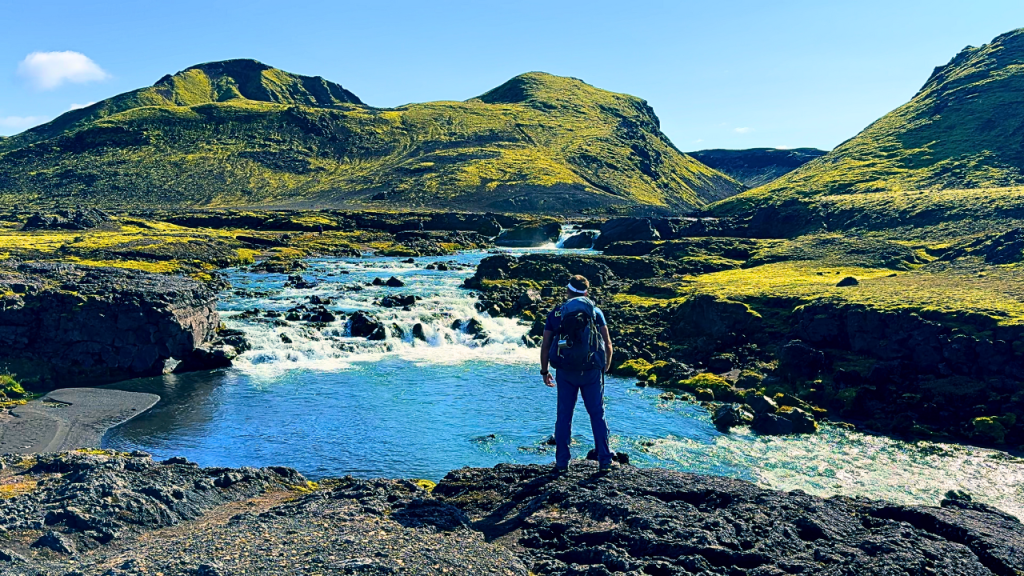
But just when the weather threatened to break me, the valley opened into a scene I’ll never forget: black volcanic sand, mossy green hills, pastel mountains in the distance, and a shimmering lake—Álftavatn lake, also known as Swan Lake—waiting at its edge. The area is dotted with accommodation options, including the Álftavatn hut, Hvanngil hut, and Hvanngil mountain hut, all offering a welcome rest after a challenging day.
Arriving early meant I got a bunk by the window. That evening, I splurged on soup, salad, and an Icelandic beer. €33 never tasted so good.
Day 3: Álftavatn → Emstrur (15 km | 6–7 hrs)
This was the day I’d been waiting for. I woke up to clear skies and golden sunlight reflecting off the lake. No rain, no wind, just perfect hiking weather.

The trail wound through mossy valleys and tiny streams before shifting into something that felt alien—an endless stretch of volcanic terrain, with black volcanic rock underfoot and dramatic volcanic mountains looming ahead. The landscape was stark and otherworldly, a true highlight of the epic adventure that is the Laugavegur trek. Along the way, the magnificent Markarfljót canyon appeared, its dramatic depths carved by ancient volcanic floods, offering breathtaking views and a reminder of Iceland’s powerful geological forces.

By the time I reached the Botnar Mountain Hut at Emstrur, my legs were heavy, but the promise of a shower (ISK 1,000 for five minutes) gave me a burst of energy. Standing under that hot water, timer ticking, felt like pure luxury. Later, as I slurped freeze-dried noodles, I watched a guided group barbecue salmon outside. I’ll admit, a small part of me envied them—but whiskey shared with new trail friends was a worthy consolation prize.
Day 4: Emstrur → Þórsmörk (15 km | 7–8 hrs)
The final stage began under heavy clouds. My legs ached, but the landscape kept pulling me forward—steep descents into dramatic gorges, mossy cliffs, and rivers roaring through narrow canyons. This was truly a challenging hike through the heart of the Icelandic Highlands, with the stunning scenery of volcanic terrain and distant views of the Mýrdalsjökull and Eyjafjallajökull glaciers dominating the horizon.

Then came the widest and most memorable final river crossing yet. This final crossing before reaching Þórsmörk was a true milestone. I picked my line, planted my poles, and stepped into water that immediately froze my calves. Every rock shifted underfoot. For a moment, I thought I’d lose my balance, but slow steps got me to the other side. My pride was intact, if not my feeling in my toes.
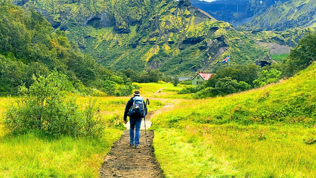
Soon after, the scenery softened—shrubs, then bushes, and finally something Icelanders proudly call a “forest.” To anyone else, it looks like waist-high trees, but after days in the highlands, it felt lush and alive. The lush greenery and stunning scenery of Þórsmörk valley were a welcome contrast to the rugged highlands behind me.
I accidentally stopped at the Volcano Huts, thinking my hike was over. That mistake earned me a burger and a cold beer—an ending so perfect I didn’t mind walking the last stretch to my actual hut in Þórsmörk.
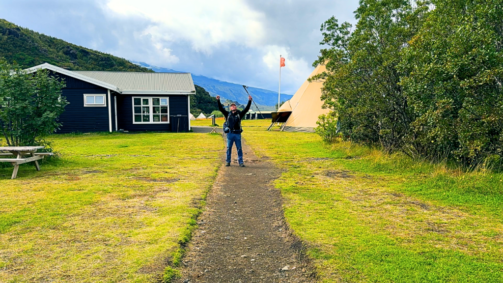
That night, sitting in my bunk with sore legs and a full stomach, I realized I’d done it: four days, 55 km, across one of the wildest, most unpredictable landscapes I’d ever seen.
Also Read: Best Hiking Drones
Reflections
The Laugavegur trail gave me everything—rainbows and storms, beauty and brutality, solitude and unexpected friendships. Every day felt like stepping onto a different planet. And just when I thought it was over, I knew I still had the Fimmvörðuháls trail waiting, with volcanoes, glaciers, and Skógafoss as the grand finale.
Reflecting on the entire trip, I can honestly say it was an amazing trip and the experience was absolutely amazing from start to finish.
For now, though, I let myself sit with the satisfaction. I’d made it. Iceland had tested me, and I’d passed—cold feet, tired legs, and all.
How Hard is the Laugavegur Trail?
The Laugavegur trek isn’t the toughest long-distance hike in the world, but it’s no casual stroll either. The trail takes most hikers between 3 to 5 days to complete, depending on pace and weather conditions. Its challenge comes less from technical climbing and more from unpredictable weather, daily distances, and the sheer variety of terrain, including steep climbs, steep ascents, steep hills, and the occasional steep descent.

Trail Difficulty
- Distance: 55 km (34 miles), usually over 4 days
- Daily Hiking: 12–15 km (4–8 hours of walking per day)
- Terrain: Volcanic sand, lava fields, snow patches, black deserts, rivers, and mossy valleys
- Elevation Gain: Moderate—steady climbs, but nothing extreme compared to alpine treks
Main Challenges
- Weather: Sun, rain, wind, and snow can all hit in the same day. Exposure on high plateaus makes wind and cold especially tough.
- River Crossings: Expect multiple glacial rivers without bridges. Water is icy, currents can be strong, and crossings are unavoidable.
- Huts & Camping: Shared huts are cozy but crowded. Campers face tough conditions with wind and rain.
- Isolation: No shops or services between huts except small supplies. You carry your food and gear.
- Fatigue: Four long days in a row can wear you down, especially if you’re not used to multi-day hikes.
Who Can Do It?
- Anyone with moderate hiking experience and good fitness can complete the trail.
- No technical climbing is required, but stamina, preparation, and gear matter.
- If you’ve done long day hikes (6–8 hrs) or shorter multi-day treks before, you’ll be fine.
Fitness Level Required
Think of it as four consecutive days of medium–long hikes with a pack. If you can comfortably hike 15–20 km in one day at home, you’re ready.
The hardest parts for most hikers aren’t the climbs—it’s the cold river crossings and weather mood swings. Train your endurance, pack proper gear, and you’ll manage.
What Gear Will You Need on the Laugavegur Trail?
The Laugavegur trek takes you through volcanic deserts, snow patches, steaming valleys, and glacial rivers. The weather is unpredictable, so having the right gear is the difference between enjoying the adventure and simply surviving it.

Here’s a breakdown of the essentials:
Sleeping and Shelter:
Whether you stay in mountain huts or camp outdoors, you will need to bring your own sleeping bag. Most huts do not provide bedding, so hikers should pack suitable sleeping bags for warmth and comfort. If you are camping, a quality tent and sleeping bags are necessary for protection against the elements.
Cooking and Food:
If you plan to prepare your own meals, bringing camping gas is essential for cooking at campsites or in designated hut kitchens. Make sure to pack lightweight cookware and enough food for the trek.
Clothing
- Waterproof jacket & pants → Breathable, durable, with sealed seams.
- Base layers → Merino wool or synthetic; avoid cotton.
- Insulating mid-layer → Fleece or lightweight down jacket.
- Hiking pants & quick-dry shirts → Comfortable for long days.
- Gloves & hat/beanie → Even in July, it can be near freezing.
- Extra socks & underwear → Quick-dry and warm.
Also Read: Best Hiking Gloves
Footwear
- Sturdy hiking boots → Waterproof, broken in, with ankle support.
- Camp shoes/sandals → For river crossings and relaxing at huts.
- Gaiters (optional) → Useful in snow patches or wet sand.
Backpack & Storage
- 40–60L backpack → Enough for multi-day trekking gear.
- Rain cover & dry bags → Keep clothes and electronics dry.
- Daypack (optional) → Handy if doing side trips.
Also Read: Best Hiking Daypacks
Sleeping & Shelter
- Sleeping bag → Required in huts (no bedding provided).
- Sleeping pad & 4-season tent (if camping).
- Earplugs → For snoring bunkmates in huts.
Cooking & Food
- Stove, fuel & lighter (if camping/self-catering).
- Lightweight cookware & utensils.
- Freeze-dried meals & snacks.
- Reusable water bottle (1L+) or hydration system.
- Water purification tablets/filter (streams are usually safe but be prepared).
Navigation & Safety
- Trail map & compass / GPS (the trail is marked, but weather can obscure signs).
- Trekking poles → Essential for balance in river crossings and steep descents.
- Headlamp → Especially useful in late August/September when nights are darker.
- First-aid kit → Include blister plasters, pain relief, and bandages.
- Emergency blanket / bivy.
Also Read: Best Hiking Watches
Electronics & Extras
- Power bank/solar charger → No outlets in huts.
- Camera/GoPro/phone → To capture the landscapes.
- Whiskey or small comfort treat → Great for trail morale.
- Cash or card → Some huts sell food, drinks, or showers.
Also Read: Best Trekking Poles
Pack light but don’t cut corners on warmth and waterproofing. Iceland’s weather can shift from sunny to snowstorm within minutes. A properly layered system and dry gear are your best insurance.
Suggested Itineraries for the Laugavegur Trail
The Laugavegur hike is a well-known multi-day adventure in Iceland, offering flexibility—you can complete the hiking trail in 2, 3, 4, or even 6 days depending on your pace, fitness, and whether you include the Fimmvörðuháls extension. Here are the most common itineraries to help you choose:
Classic 4-Day Itinerary (Most Popular)
- Day 1: Landmannalaugar → Hrafntinnusker (12 km, 4–5 hrs)
- Day 2: Hrafntinnusker → Álftavatn (12 km, 4–5 hrs)
- Day 3: Álftavatn → Emstrur (15 km, 6–7 hrs)
- Day 4: Emstrur → Þórsmörk (15 km, 7–8 hrs)
Balanced pace, enough time to enjoy the huts and scenery.
3-Day Itinerary (Faster Hikers)
- Day 1: Landmannalaugar → Álftavatn (24 km, 8–10 hrs)
- Day 2: Álftavatn → Emstrur (15 km, 6–7 hrs)
- Day 3: Emstrur → Þórsmörk (15 km, 7–8 hrs)
Cuts one overnight but requires long hiking days.
2-Day Itinerary (Trail Runners / Ultra-Hikers)
- Day 1: Landmannalaugar → Emstrur (39 km, 10–12 hrs)
- Day 2: Emstrur → Þórsmörk (15 km, 7–8 hrs)
Possible in good weather but demanding—best for very fit hikers.
Extended 6-Day Itinerary (With Fimmvörðuháls Extension)
- Day 1: Landmannalaugar → Hrafntinnusker (12 km, 4–5 hrs)
- Day 2: Hrafntinnusker → Álftavatn (12 km, 4–5 hrs)
- Day 3: Álftavatn → Emstrur (15 km, 6–7 hrs)
- Day 4: Emstrur → Þórsmörk (15 km, 7–8 hrs)
- Day 5: Þórsmörk → Fimmvörðuháls (12 km, 6–7 hrs)
- Day 6: Fimmvörðuháls → Skógar (13 km, 6–7 hrs)
Adds glaciers, volcanoes, and the famous Skógafoss waterfall as the grand finale.
Which Itinerary Should You Choose?
- 4-Day: Best for most hikers—steady pace with time to rest.
- 3-Day: Great if you’re short on time but still want the full trek.
- 2-Day: Only for highly experienced hikers or trail runners.
- 6-Day: Perfect if you want the full adventure and don’t mind extra effort.
How to Train for the Laugavegur Trail
The Laugavegur trail doesn’t require technical mountaineering skills, but it does demand endurance, strength, and preparation. Training properly will make your hike safer and far more enjoyable.
1. Build Endurance with Long Hikes
- Aim for weekly hikes of 10–20 km with a backpack.
- Add multi-day hikes or back-to-back training days to simulate the trek.
- Practice on uneven ground—sand, gravel, mud—to mimic Iceland’s terrain.
2. Strengthen Your Legs and Core
Focus on exercises that prepare you for climbs, descents, and carrying a pack:
- Squats & lunges → build leg strength
- Step-ups → mimic uphill hiking
- Planks & core rotations → improve balance and stability
3. Train with a Backpack
- Start with light weight and increase gradually to 8–12 kg.
- Include hill climbs or stair workouts with the pack.
- This conditions your body for the daily load.
4. Improve Cardio Fitness
- Add running, cycling, or rowing sessions 2–3 times per week.
- Interval training (short bursts of high effort) helps for the sudden climbs.
5. Practice River Crossings
- Train balance by walking across shallow streams near home.
- Practice using trekking poles for stability.
- Get used to the shock of cold water—icy rivers are part of the Laugavegur experience.
6. Prepare Mentally
- Expect long days, variable weather, and shared huts.
- Build resilience by hiking in the rain or wind during training—comfort outside your comfort zone.
Training Timeline: Start preparing at least 8–12 weeks before your trek. With consistent hiking, strength work, and backpack training, you’ll be ready to enjoy Iceland’s landscapes instead of just surviving them.
What Accommodations Are Before, During, and After the Laugavegur Trail?
Where you stay plays a huge role in how comfortable (or rugged) your Laugavegur trek will be. Luckily, Iceland offers options both before and after the hike, plus a network of huts and campsites along the trail itself. In most sections, you can count on a safe hut nearby, providing secure shelter in challenging conditions.
Before the Trail (Landmannalaugar)
- Camping: A large campsite right at the trailhead with toilets and basic facilities.
- Mountain Hut (Landmannalaugar Hut): Beds, kitchen, and communal space (book early).
- Nearby Options: Some private lodges and hotels in the Highlands, but most hikers come by bus and camp or stay in the hut.
During the Trail (On-Route Huts & Campsites)
Managed by FI (Iceland Touring Association), the huts are rustic but cozy. Each hut has:
- Shared dorm-style bunk beds (bring a sleeping bag).
- Communal kitchens with stoves, cookware, and running cold water.
- Wardens on-site with weather updates and safety advice.
- Toilets (flush or outhouse, depending on location).
- Some huts offer limited snacks, drinks, or meals (Álftavatn, Þórsmörk).
Key accommodation options along the trail include the botnar mountain hut, hvanngil mountain hut, and hvanngil hut, each serving as important resting points for hikers.
Campsites are next to the huts and provide toilets and water access. No wild camping is allowed.
Hut Locations Along the Laugavegur Trail:
- Hrafntinnusker
- Álftavatn
- Hvanngil hut / Hvanngil mountain hut (alternative to Álftavatn, smaller, quieter)
- Emstrur (Botnar) / Botnar mountain hut
- Þórsmörk (Langidalur, Básar, Volcano Huts)
New Hut Booking System
As of 2025, the FI huts must be booked online in advance through the official Ferðafélag Íslands (FI) website. Key points:
- No walk-ins are allowed; spots sell out months ahead.
- Bookings open in January/February for the summer season.
- Payment is required at booking.
- Cancellations/refunds are limited, so plan carefully.
- Campsites usually don’t need advance booking, but expect crowds in July/August.
After the Trail (Þórsmörk & Skógar)
- Þórsmörk: Several huts and Volcano Huts (with a restaurant, bar, WiFi, and private rooms). Great for relaxing before heading back.
- Skógar (if continuing via Fimmvörðuháls): Guesthouses, hotels, and campsites near Skógafoss waterfall. Perfect for a hot shower and proper bed.
If you want the hut experience, book as early as possible—especially for July and August. For flexibility, camping is cheaper and easier, but you’ll need a reliable 4-season tent and solid gear for Iceland’s unpredictable weather.
How Much Does It Cost to Hike the Laugavegur Trail?
Here’s a breakdown of the expected costs when doing Laugavegur (plus the Fimmvörðuháls extension), so you can budget realistically. Prices are in Icelandic króna (ISK) unless otherwise noted, and valid for 2025, though some variation depending on service, season, and how early you book.
| Category | Typical Cost | What’s Included / Things to Know |
|---|---|---|
| Accommodation – FI Huts | ~ 15,800 ISK per person/night in major huts (Álftavatn, Hrafntinnusker, Landmannalaugar, Þórsmörk etc.) | Dorm-style bunk, sleeping bag needed. Basic facilities; some huts have no showers. Prices increased in 2025. |
| Accommodation – Less busy huts / smaller huts | ~ 8,400 – 11,000 ISK per person/night | Smaller huts, fewer beds, often more rustic. |
| Camping (next to huts) | ~ 3,200 ISK per person/night | Campsites provide toilets and basic water. No access to the dorm or indoor lounge unless staying in hut. |
| Hot Shower | ~ 1,000 ISK per use | Showers are limited in some huts — check in advance. |
| Bus / Transfer (Reykjavík ↔ Trailheads) | One-way Reykjavík to Landmannalaugar ~ 12,500 ISK Return + other transfers can make this ~25,000–28,000 ISK depending on route & operator (if using “Hikers Bus Pass”) | Book ahead during summer. Road conditions / weather can affect scheduling. |
| Food, Snacks, and Hut Store Purchases | Varies widely: budget more for packed meals + extras Hut stores are expensive for basics (chocolate, snacks, drinks) | You’ll need to bring most food; only light items are sold along trail. |
| Other Costs | Travel insurance, gear, clothing, possible lodging before/after the trek in Reykjavík or Skógar etc. Might include baggage transfer or gear rental. | Gear quality can significantly impact comfort and safety. |
Estimated Budget Examples
To give you an idea, here are two example budgets for a 4-day / 5-night Laugavegur trek (no extension), with modest comfort:
| Style | Huts + Minimal Extras | Camping + Self-Sufficient |
|---|---|---|
| Accommodation (4 nights in huts) | ~ 63,200 ISK (4 × 15,800) | ~ 12,800 ISK (4 × 3,200) |
| Transfers & Bus | ~ 25,000–30,000 ISK | ~ same |
| Food & Snacks | 10,000–20,000 ISK (bring your own mostly, some hut store) | ~10,000 ISK |
| Showers & Misc | ~ 1,000–2,500 ISK | same or less |
| Estimated Total | ~100,000–120,000 ISK (~US$700–850 / €620–750) | ~60,000–75,000 ISK (~US$420–550 / €370–470) |
What Affects Cost Most
- Hut vs camping — staying in huts is 3-5x more expensive than camping.
- Booking early & season — peak summer = higher demand & higher cost; off-peak or early booking helps.
- Transfers — where you start and end, which bus companies, whether you use multi-point or return ticket passes.
- Food + gear — bringing bulk food is cheaper; buying on the trail costs more. Good gear upfront saves money (vs emergencies).
My Personal Tips for Hiking the Laugavegur Trail
After six days on the Laugavegur trail (plus the Fimmvörðuháls extension), I picked up some lessons the hard way. These tips will help you avoid common mistakes and make the trek smoother, safer, and more enjoyable.
1. Book Early (Really Early)
- Huts open for booking in January/February and sell out fast.
- If you miss out, camping is your backup—but you’ll need solid gear.
2. Start Early Each Day
- Weather usually worsens in the afternoon.
- Leaving early gives you calmer conditions and first choice of bunks.
3. Be Ready for River Crossings
- Always carry sandals or neoprene shoes and trekking poles.
- Cross where the current is widest (shallower, slower water).
- Don’t underestimate how cold glacier rivers can be.
4. Layer, Don’t Overpack
- Iceland is about layering, not bulk.
- A base layer + mid-layer + waterproof shell is more effective than heavy gear.
5. Respect the Wardens
- Hut wardens are more than caretakers—they’re your lifeline for safety updates.
- Always check the daily forecast they provide before starting your stage.
6. Carry Comfort Food
- After long days, little treats (crisps, chocolate, whiskey) make a huge difference.
- Hut shops exist but are very expensive.
7. Protect Your Feet
- Change into dry socks after river crossings.
- Use blister plasters at the first sign of rubbing.
- Don’t hike in brand-new boots.
8. Manage Expectations
- Some days are pure magic (blue skies, epic views).
- Others are grey, wet, and cold—but still unforgettable in their own way.
- Embrace the unpredictability; it’s part of the Laugavegur experience.
9. Bring Earplugs
- Huts are crowded, and there’s always at least one world-class snorer.
- Best sleep investment you’ll make.
10. Don’t Skip the Fimmvörðuháls Extension
- If you have two extra days, keep going from Þórsmörk to Skógar.
- You’ll pass between glaciers, over volcanic craters, and finish at Skógafoss waterfall—one of Iceland’s most dramatic endings.
The Laugavegur isn’t about racing—it’s about soaking in some of the most surreal landscapes on Earth. Slow down when you can, look around, and let Iceland surprise you.
What Are Some Alternative Hikes to the Laugavegur Trail?
If the Laugavegur trail doesn’t fit your schedule, or if you want more ideas after completing it, Iceland offers other world-class treks. Some are shorter, some longer, but all deliver Iceland’s unique blend of fire, ice, and wilderness. For experienced hikers seeking solitude and independence, solo hiking on these alternative routes is also an option, though it requires careful preparation and self-sufficiency due to Iceland’s challenging conditions.
1. Fimmvörðuháls Trail (25 km, 1–2 days)
- Route: Þórsmörk → Skógar
- Highlights: Cross between two glaciers (Eyjafjallajökull & Mýrdalsjökull), pass fresh volcanic craters from the 2010 eruption, and finish at Skógafoss waterfall.
- Why: Often hiked as an extension to the Laugavegur. Short but packed with drama.
Also Read: Fimmvörðuháls Trail Guide
2. Hornstrandir Nature Reserve (Multi-day)
- Location: Remote Westfjords
- Highlights: Arctic foxes, sea cliffs, endless solitude.
- Why: No huts or infrastructure—this is wild Iceland at its most untouched. Best for experienced backpackers.
3. Víknaslóðir / The Trails of the Inlets (3–7 days)
- Location: Eastfjords
- Highlights: Remote fishing villages, dramatic fjords, colorful rhyolite mountains.
- Why: A quieter, less crowded alternative with a mix of coastal and highland scenery.
4. Askja & Víti Crater (Day Hike)
- Location: Central Highlands
- Highlights: Volcanic deserts, lunar-like landscapes, and the blue Víti crater lake.
- Why: Feels like hiking on another planet. Popular with geology lovers.
5. Glymur Waterfall Hike (1 day)
- Location: Near Hvalfjörður, West Iceland
- Highlights: Iceland’s second-highest waterfall, gorge crossings, caves.
- Why: A challenging day hike close to Reykjavík, great if you’re short on time.
6. International Alternatives
If you’re inspired by Laugavegur and want similar long-distance treks elsewhere:
- West Highland Way (Scotland) – 154 km, rolling highlands and lochs.
- Alta Via 1 (Dolomites, Italy) – 120 km, hut-to-hut alpine classic.
- Kungsleden (Sweden) – 400+ km, Arctic wilderness above the Arctic Circle.
- Tour du Mont Blanc (France/Italy/Switzerland) – 170 km, iconic alpine loop.
If it’s your first trek in Iceland, stick with Laugavegur or Fimmvörðuháls. For more solitude, try Hornstrandir or Víknaslóðir.
FAQ: Hiking the Laugavegur Trail
Here are answers to the most common questions hikers ask before tackling Iceland’s most famous trek.
What does ‘Laugavegur’ mean?
‘Laugavegur’ translates to ‘hot spring way’ in Icelandic, combining the word for ‘hot spring’ with ‘way’ or ‘path.’ This name reflects the presence of hot springs along the route and highlights their cultural and linguistic significance in Iceland.
How long is the Laugavegur Trail?
The Laugavegur Trail is approximately 55 kilometers (34 miles) long. Laugavegur hiking is a popular activity, attracting trekkers from around the world to experience Iceland’s unique landscapes.
How long is the Laugavegur Trail?
The trail is 55 km (34 miles) from Landmannalaugar to Þórsmörk. Most people complete it in 4 days, though it can be done in 2–3 days or extended to 6 days if you add the Fimmvörðuháls trail to Skógar.
How difficult is it?
Moderate. Daily distances are 12–15 km, with steady climbs and descents. The biggest challenges are unpredictable weather and icy river crossings. Anyone with decent fitness and some hiking experience can complete it.
When is the best time to go?
From late June to early September, when huts, buses, and roads are open. Mid-July to mid-August offers the most stable weather but also the biggest crowds.
Do I need to book huts in advance?
Yes. As of 2025, huts must be booked online months in advance through the Iceland Touring Association (FI). Walk-ins are no longer allowed. Campsites don’t usually require booking, but they fill up in peak season.
Can I camp instead of using huts?
Yes. Campsites are available at every hut location. Wild camping is not allowed. Bring a strong 4-season tent, as winds can be brutal.
How do I get to the trail?
Highland buses run from Reykjavík to Landmannalaugar (start) and from Þórsmörk or Skógar (finish). You can also drive, but a 4×4 vehicle is required for the F-roads leading to Landmannalaugar.
What about food?
Bring most of your own food. Huts have kitchens with stoves but no groceries. Some huts (like Álftavatn and Þórsmörk) sell limited snacks, drinks, and meals—but at high prices.
How much does it cost?
- Huts: ~15,800 ISK per night
- Camping: ~3,200 ISK per night
- Bus transfers: ~25,000 ISK round trip
- Food: 10,000–20,000 ISK if you self-cater
- Total: Expect 60,000–120,000 ISK (€400–850) for the full trek depending on comfort level.
Are river crossings dangerous?
Most are safe if crossed carefully, but the water is freezing and fast-moving. Always cross at the widest point, use poles for balance, and unclip your backpack straps in case you fall.
Do I need a guide
Not necessarily. The trail is well-marked and doable self-guided with preparation. Guided tours are a good option if you prefer group support, don’t want to carry food/gear, or want extra safety in poor conditions.
Is it safe to hike solo?
Yes, many hikers do it solo. Just be prepared for solitude on certain stretches and always check daily weather forecasts at the huts.
Can I hike Laugavegur in winter?
No. Outside the summer season, huts are closed, buses stop running, and heavy snow makes the trail dangerous without advanced mountaineering experience.
Treat the Laugavegur with respect. The landscapes are surreal and beautiful, but the conditions are harsh and unpredictable. Prepare well, book early, and you’ll have one of the most unforgettable trekking experiences of your life.